- The Library Shop
- Privacy Policy
- Rules and Regulations
- Using the Internet
- Website Terms and Conditions
- Gifts of Materials to NYPL
-
© The New York Public Library, 2024
The New York Public Library is a 501(c)(3) | EIN 13-1887440
Explore 875,460 items digitized from The New York Public Library's collections.
This site is a living database with new materials added every day, featuring prints, photographs, maps, manuscripts, streaming video, and more.
Our collections include some content that may be harmful or difficult to view. Learn more
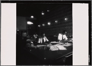
![The Bell Telephone hour. [February 16, 1965]](https://images.nypl.org/index.php?id=4031904&t=t)
The Bell Telephone hour. [February 16, 1965]
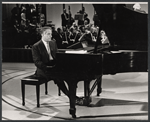
![Max Morath [at piano] and unidentified others on the television program The Bell Telephone Hour [February 2, 1965]](https://images.nypl.org/index.php?id=4031903&t=t)
Max Morath [at piano] and unidentified others on the television program The Bell Telephone Hour [February 2, 1965]
![Louis Armstrong [left], Jane Powell [second from left], Dale Evans [second from right], Roy Rogers [right] and unidentified [center] with unidentified otheres in background on the television program The Bell Telephone Hour](https://images.nypl.org/index.php?id=4031902&t=t)
Louis Armstrong [left], Jane Powell [second from left], Dale Evans [second from right], Roy Rogers [right] and unidentified [center] with unidentified otheres in background on the television program The Bell Telephone Hour
![Roy Rogers and Dale Evans on the television program The Bell Telephone Hour [February 2, 1965]](https://images.nypl.org/index.php?id=4031901&t=t)
Roy Rogers and Dale Evans on the television program The Bell Telephone Hour [February 2, 1965]
![The Columbus Boychoir performing in the "Christmas Celebration" episode of The Bell Telephone Hour [December 22, 1964]](https://images.nypl.org/index.php?id=4031900&t=t)
The Columbus Boychoir performing in the "Christmas Celebration" episode of The Bell Telephone Hour [December 22, 1964]
![Unidentified man and guest hostess Maureen O'Hara in rehearsal for the "Christmas Celebration" episode of The Bell Telephone Hour [December 22, 1964]](https://images.nypl.org/index.php?id=4031899&t=t)
Unidentified man and guest hostess Maureen O'Hara in rehearsal for the "Christmas Celebration" episode of The Bell Telephone Hour [December 22, 1964]
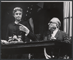
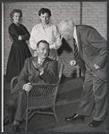
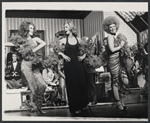
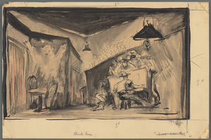
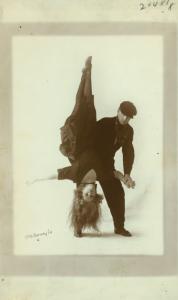
Betty Field and Ed Begley in the stage production Banderol
Ed Begley and Ann Harding in the stage production Banderol
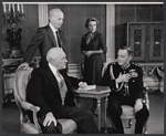
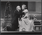
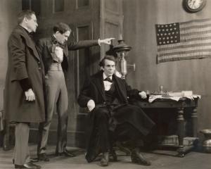
Maurice Evans (seated right) and unidentified cast members in the stage production The Apple Cart
Signe Hasso and Maurice Evans in rehearsal for the stage production The Apple Cart
Maurice Evans (seated) and unidentified cast members in rehearsal for the stage production The Apple Cart
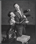
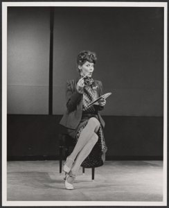
Patrice Munsel and company in the touring stage production Applause
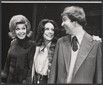
Lisa Carroll, Patrice Munsel, and Stephen Everett in the touring stage production Applause
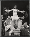
Pia Zadora (center) and dancers in the touring stage production Applause
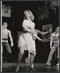
Lauren Bacall and dancers in the touring stage production Applause
Lauren Bacall and dancers in the touring stage production Applause
![Howard Keel, Barbara Cook and Anita Gillette [center] on the television program The Bell Telephone Hour](https://images.nypl.org/index.php?id=4031922&t=t)
Howard Keel, Barbara Cook and Anita Gillette [center] on the television program The Bell Telephone Hour
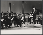
![The Bell Telephone hour. [November 7, 1965]](https://images.nypl.org/index.php?id=4031921&t=t)
The Bell Telephone hour. [November 7, 1965]
![Benny Goodman on the television program The Bell Telephone Hour [October 24, 1965]](https://images.nypl.org/index.php?id=4031920&t=t)
Benny Goodman on the television program The Bell Telephone Hour [October 24, 1965]
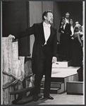
Victor Borge in the October 24, 1965 episode of on the television program The Bell Telephone Hour
![Louis Teicher [left], Ella Fitzgerald [center] and Art Ferrante [right] in the September 26, 1965 episode of on the television program The Bell Telephone Hour](https://images.nypl.org/index.php?id=4031918&t=t)
Louis Teicher [left], Ella Fitzgerald [center] and Art Ferrante [right] in the September 26, 1965 episode of on the television program The Bell Telephone Hour
Earl Wrightson in the September 26, 1965 episode of on the television program The Bell Telephone Hour
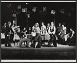
The Bell Telephone Orchestra in the April 27, 1965 episode of on the television program The Bell Telephone Hour
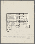
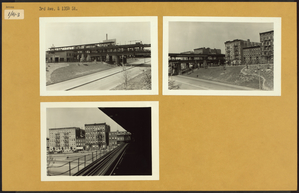
Exhibition plan, Royal Academy Galleries
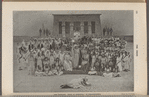
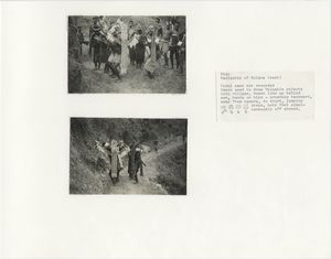
The Pageant "Star of Ethiopia" in Philadelphia


The New York Public Library recently enhanced access to all public domain items in Digital Collections so that everyone has the freedom to enjoy and reuse these materials in almost limitless ways.

Decorative prints for purchase: choose from archival prints framed art stretched canvas vintage wood and wall murals.


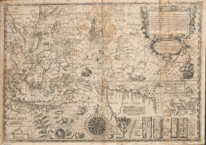


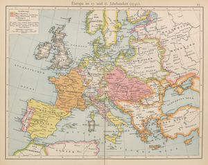
![Printed maps of Russia and neighboring lands, including city plans of Saint Petersburg, from the 17th to the early20th century].](https://images.nypl.org/index.php?id=2003589&t=r)


Here are some other ways you can access and engage with digital content at NYPL and beyond

Decorative prints for purchase: choose from archival prints, framed art, stretched canvas, vintage wood, and wall murals.

Contains finding aids for over 10,000 unique collections (digitized and non-digitized) in almost every conceivable format.

The online catalog of The Miriam and Ira D. Wallach Division of Art, Prints and Photographs.

The Library's digitized collections are available as machine-readable data: over 1 million objects and records for you to search, crawl and compute.

Brings together the riches of America's libraries, archives, and museums, and makes them freely available to the world.

Browse and download NYPL's digital maps, and align historic maps with the geography of today.

A tool where you can help unlock New York City's past by identifying buildings and other details on beautiful old maps.

A tool for creating and sharing 3D images from stereograph collections.

A tool for transcribing historical restaurant menus.

An initiative underway at NYPL branch libraries that aims to document, preserve, and celebrate the rich history of the New York's unique neighborhoods.

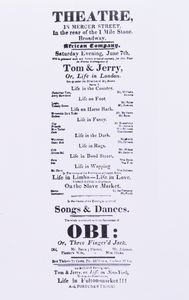
Help reconstruct theater history by transcribing old New York City playbills.

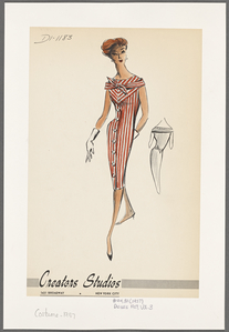
Fashion Drawings & Sketches in the Collections of FIT and the New York Public Library.

A partnership of academic & research institutions, offering a collection of millions of titles digitized from libraries around the world.